INTRODUCTION TO MULTIBEAM ECHO SOUNDER
An advanced sonar system used for mapping the seafloor is called a Multibeam echosounder. It operates by concurrently producing several sound waves at various angles, resulting in a larger coverage area and more precise data collecting.
In order to produce a 3D image of the topography of the seafloor, the system monitors the time it takes for sound waves to bounce off the seafloor and return to the sensor. Multibeam echosounders are employed in several projects:
- Multibeam Echo sounders are used in oceanography research to examine the seafloor and various oceanographic phenomena, including tides and currents.
- Marine Geology: Multibeam echosounders are utilized to map the seafloor and locate geological features such as underwater volcanoes, canyons, wrecks and ridges.
- Multibeam Echosounders are used in hydrographic surveys to produce precise nautical charts of an area.
- Marine habitat mapping – Multibeam echosounders can be used to map the seafloor and identify different habitats and ecosystems. This information can be used for conservation and management purposes.
- Navigation and charting – Multibeam echosounders are used to create accurate nautical charts for safe navigation in shallow waters.
- Offshore oil and gas exploration – Multibeam echosounders are used to map the seafloor and identify potential.
Moreover, it depict wide profile of depths in a line perpendicular to the ship’s direction of travel.
www.surveytechno.com
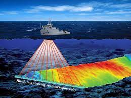
It transmit/ receive multiple beams in Single transmission. Further, it enhanced the productivity, bottom coverage, resolution and confidence level.
It also provides precise backscatter measurements in some systems. It is better than single beam echo sounders.
Multibeam Echosounder Operation
- It is not too dissimilar in principle to a conventional echo sounder
- Instead of having a single (or dual) transmit and receive transducer head, an array of transducers is used which are electronically scanned
- MBES not only looks directly below the transducer head, but also looks to each side
- The transmit beam is narrow in the alongtrack direction but broad in elevation
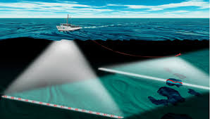
- The sonar generally consists of two hull mounted arrays arranged at right angles to each other in an L or T configuration to create a “cross fan” beam pattern
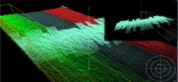
- Each array produces a beam which is narrow in the direction perpendicular to its long axis
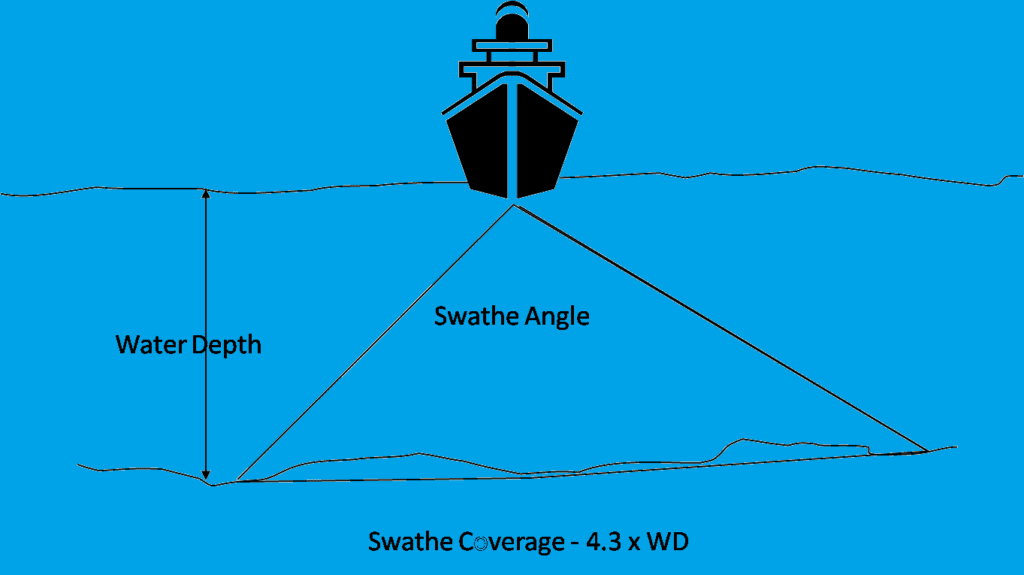
- As a consequence, a wide area of seabed can be covered in one scan or sweep depending on the depth of water

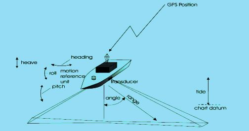
- Each individual sounding during the sweep has to be corrected for the pitch, roll and heave of the vessel in order to determine its relative position
- Computer is used to process all the data and incorporate heave, roll and pitch corrections
- Sound velocity was fed into the system manually; accurate knowledge of the SV value is even more critical than normal in a single beam system due to the effect of ray bending on acoustic slant ranges
Multibeam Echosounder Lines Layout
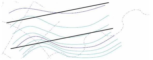
- In multibeam surveying, lines are designed to run parallel to the contours
- Line spacing is a function of swath coverage which is a function of water depth
- Surveying parallel to a ridge allows line spacing to remain the same
- As water depth remains fairly constant, surveying parallel to the contours, means less manipulation of the range settings
Multibeam Echo Sounder System Requirements
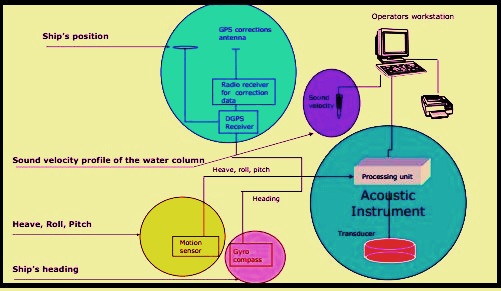
- Following systems are essential for MBES for conduct of bathymetry survey:
- Sonar Data
- Motion Sensor
- Yaw
- Pitch
- Roll
- Heave
- Gyro/ Heading
- Position Input/ GPS
- Sound Velocity Probe
Sonar Data
Swath systems, whether using beam forming or interferometry, rely on accurate angle measurement and precise placement to provide accurate maps of the seabed. The elimination of ship motion is critical for the effective operation of these devices, since any motion of the ship might create mistakes in the measured data. Roll motion is particularly problematic since it can cause the angle of the beams to vary, resulting in inaccuracies in both position and depth readings. To compensate, swath systems applications such as oceanographic research, geological surveys, marine resource exploration, and undersea infrastructure inspections are used. They are also used to identify possible risks on the bottom, such as shipwrecks or undersea detritus. Multibeam echosounders are a crucial instrument for marine scientists and engineers, offering i-e Oceanographic research, geological surveys, marine resource exploration, and undersea infrastructure inspections are some of the uses. They are also utilised to detect possible seabed dangers such as shipwrecks or underwater detritus. Multibeam echo sounders are a valuable instrument for marine scientists and engineers because they provide precise information about the seabed that can be utilized to better understand oceanic dynamics and enhance navigation safety.
Motion Sensor, Gyro and GPS
A motion sensor, such as a gyro or an inertial navigation system like POS(MV), is crucial for accurate data collection with a multibeam echosounder. The motion sensor provides information on the orientation and movement of the vessel, which is necessary for correcting the data received from the echosounder. Without this information, the data collected by the multibeam echosounder would be inaccurate and unusable. Additionally, positional data must be very precise, as it needs.
Sound Velocity Probe
A sound velocity probe is a device used to measure the speed of sound in a liquid or a gas. It is commonly used in underwater acoustics to determine the speed of sound in seawater. The probe typically consists of a small transducer that emits a sound wave and a receiver that measures the time it takes for the sound wave to travel a known distance. By measuring the time it takes for the sound wave to travel through the liquid or gas and back to the probe, the speed of sound.

Detailed blog .I like it
Nice work keep it up
Provide more information and detail about this contents
This is an Informative website about sea survey and many more advantages of this site well keep it up.
Very informative